A Comparison of High-Resolution Trajectory Methods and Their Impact on Drilling Data Analysis
SPE-212510-MSMarc Willerth; Levi Heintzelman; Joe Bauman; Ahmed Mansour; Timothy Gee; Kenneth McCarthy; Alexander Mitkus; Paul Reynerson; Tannor Ziehm
Abstract
Wellbore trajectories are a fundamental piece of data used for decisions throughout the oilfield. Trajectories are typically mapped through measurement-while-drilling (MWD) survey stations collected at 95ft intervals. Previous work suggests that this sparse sampling interval masks short segments of high curvature, negatively impacting workflows that consume this data (Stockhausen & Lesso, 2003; Baumgartner, et. al., 2019). This can come in the form of poorly estimating the true vertical depth of a well, poorly mapping geologic structure, and poorly quantifying the tortuosity of the wellpath. Several methods have previously been proposed to improve trajectory mapping by incorporating additional data collected between stationary surveys (Stockhausen & Lesso, 2003; Gutiérrez Carrilero, et al., 2018). Two sources of such data are continuous survey measurements and slide/rotate behaviors captured in slide sheets.
Two methods of improving the wellbore trajectory mapping were compared in several extended reach lateral wellbores. The impact of the new trajectories on landing point selection, dip estimation, and wellbore tortuosity analysis was determined. One method took continuous inclination data and mapped directional changes between stationary surveys. The second used bit projections generated through automated-slide-sheet analysis from real-time tool face data, estimating the location and direction of curvature produced by slide/rotate operations. These curvature estimations were used to predict wellbore shape between surveys. As a final check, in the curve sections of the wellbores, stationary surveys were collected at more frequent intervals (e.g., 31ft) to provide validation on the high-resolution trajectories and to understand the cost-benefit of simply surveying more frequently.
Both methods of high-resolution trajectories imply that errors present in a 95ft course length survey are enough to impact decisions made when drilling an extended reach lateral. Landing point estimations were shifted in several cases by over 10ft, the approximate thickness of the target formation. Similar discrepancies in true vertical depth were observed along the length of the laterals. Both methods showed strong agreement through the curve sections of the wellbore, however this agreement weakened during the lateral where short slides and geological effects on rotary tendency reduced the accuracy of the automated-slide-sheet method. A discussion of the discrepancies between the two methods in laterals is included. Dogleg severity analysis confirmed that short sections of high curvature exist that are masked by traditional 95ft survey course lengths. Surveying at 31ft intervals improves the mapping of this tortuosity but still does not capture the full effects seen on continuous survey data.
Previous work has suggested that typical wellbore trajectory mapping may be unsuitable for accurate analysis of things like geological structure and wellbore tortuosity analysis. Two methods are evaluated here that support those claims, suggesting that in the future high-resolution trajectories may be a necessity for accurate decision-making.
Related Technical Publications
-

Casing Wear and Stiff String Modeling Sensitivity Analysis – The Contribution of DP Pipe-Body and Tool-Joint on Casing Contact
Abstract Casing wear due to pipe body and tool-joint of Range 2 and Range 3 DP is compared using a stiff-string torque & drag &…
-
Fatigue Tracking for Mud Motors and MWDs in Unconventional Wells
Abstract As the industry continues to drill increasingly complex wells, the demand put on drilling equipment has increased and will continue to increase. Preventive maintenance…
-
Learning Curve Benefits Resulting From the Use of a Unique BHA Directional Behavior Drilling Performances Post-Analysis
Abstract With the current market’s high prices for drilling units and sophisticated directional and formation assessment services, low systems reliability or poor directional performance in…
Related Case Study
-
By Mitigating Motor Failures and the Associated Time Lost, Operator Saved $105,000 Per Well
H&P Technology Helped Increase Lateral Slide ROP by 120% and Make a One-Run Lateral Curve Possible
-
Operator saves 2.38 days of drilling time, equating to a savings of over $140,000 per well
Head-to-head comparison proves science-based directional drilling approach enhanced bit and BHA integrity and reduced time to target Challenge A major operator was drilling in the…
-
Operator increases rotating ROP and enhances bit and BHA integrity with Flexdrill® technology
Challenge An operator drilling out of the Meramec formation in Oklahoma historically struggled with suboptimal rates of penetration (ROP) due to stick slip and whirl.…
Related Product Literature
-
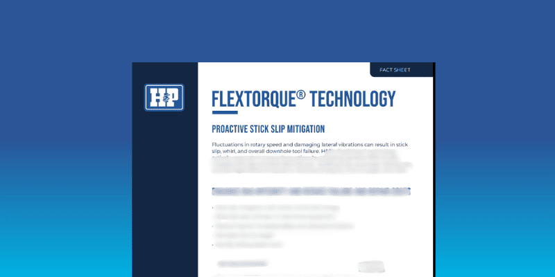
FlexTorque® software | Fact Sheet
H&P’s FlexTorque® technology actively responds to torque fluctuations by adjusting top drive RPM to help mitigate stick slip and other BHA failures. Fill out the…
-
FlexB2D® 2.0 technology | Fact Sheet
Fill out the form below to access the fact sheet
-
StallAssist® software | Fact Sheet
Detect, mitigate, and recover from downhole stalls This technology can help decrease sidetracks or lost in hole occurrences and increase motor and bit longevity, translating…