
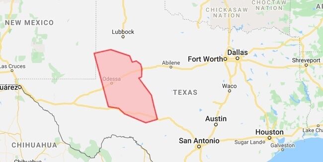
Permian Basin East | IFR1 Master Model
For a given oil field location, H&P searches for existing public and proprietary magnetic surveys. See our list of non-exclusive aeromagnetic surveys owned or distributed by H&P. All data is available for purchasing and licensing. Please contact us for pricing and options to acquire additional data.
Download Map: PDF
Type
Aeromagnetic
Line Miles
23,193
Survey Identifier
MV-A1
Line Kilometers
37,325
Survey Location
Permian Basin, Texas
Line/Tie-line Spacing
1 x 5 mile grid
Date Flown
May 2014 – June 2014, May 2015
Line/Tie-line Direction
NE-SW/SE-NW
Flight Altitude
1500m Above Ellipsoid
Flown By
Sander Geophysics Ltd. and EDCON-PRJ